Surrounding areas: Papaaloa, Hawaii (5.3 mi), Ninole, Hawaii (7.3 mi), Akaka Falls, Hawaii (9.9 mi), Pepeekeo, Hawaii (13.2 mi), Papaikou, Hawaii (15.9 mi), Honokaa, Hawaii (16.1 mi), Hilo, Hawaii (21.4 mi)
|

|
Laupahoehoe Vacation Rentals
|

|
|
|
|
|
Laupahoehoe Hotels and Resorts
|
|
|
| | | Hotels & Motels |
| Volcano House | Hawaii Volcanos National Park | Hilo, HI | 19.8 mi. | (808) 967-7321 | | Hilo Hawaiian Hotel | 71 Banyan Dr | Hilo, HI | 20.4 mi. | (808) 935-9361 |
| | | Bed & Breakfast |
| Shipman House Bed & Breakfast | 131 Kaiulani St | Hilo, HI | 19.8 mi. | (808) 934-8002 |

|
Laupahoehoe Weather & Climate
|

|
|
|
The east coast of The Big Island is one of the wettest regions in Hawaii with over 130 inches of rainfall each year. Due to the amount of precipitation, tropical rainforest and steep forested mountains also make it one of the most beautiful. The area right along the coast has temperatures that vary little because the thousands of miles of ocean surrounding the island moderates both air and water temperatures. However, the higher in elevation you go, the more extreme the temperatures. This means it can be 80 degrees at the beach and only 50 at the mountain summits. Due to moisture laden oceanic tradewinds, expect rainfall almost every day on the windward east coast, although showers generally occur in the evening hours and are short, especially during the summer months. Occasionally hurricanes reach Hawaii, although they are less frequent on the islands than in the South Pacific.
|
| Month |
High Temp |
Low Temp |
Rainfall |
Ocean Temp |
| January |
76°F |
64°F |
12.30 in. |
72°F |
| February |
76°F |
64°F |
9.03 in. |
72°F |
| March |
76°F |
64°F |
15.68 in. |
71°F |
| April |
76°F |
65°F |
15.60 in. |
72°F |
| May |
77°F |
66°F |
7.64 in. |
72°F |
| June |
79°F |
68°F |
5.94 in. |
74°F |
| July |
80°F |
69°F |
9.44 in. |
74°F |
| August |
81°F |
69°F |
8.70 in. |
75°F |
| September |
81°F |
70°F |
6.10 in. |
75°F |
| October |
80°F |
69°F |
7.22 in. |
75°F |
| November |
79°F |
68°F |
13.64 in. |
74°F |
| December |
77°F |
65°F |
10.29 in. |
73°F |

|
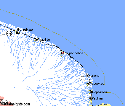
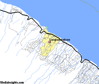
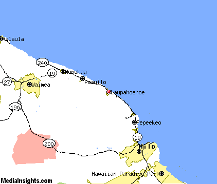
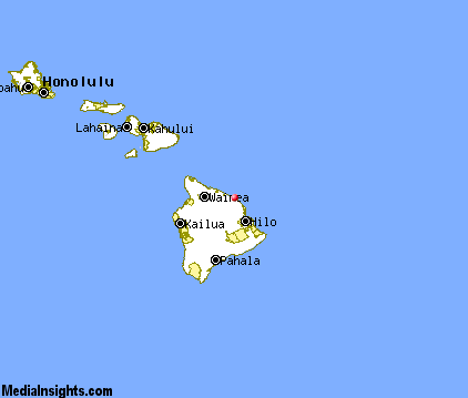
Laupahoehoe Map & Transportation
|

|
|
 |
|
|
| Click each thumbnail image to enlarge. |
 |
|
 |
 |
The closest airports in the area are the Hilo International airport (ITO) located about 21 miles southeast of Laupahoehoe in Hilo, Hawaii, the Waimea Kohala airport (MUE) located approximately 27 miles west of Laupahoehoe in Kamuela, Hawaii, and finally the Kona International At Keahole airport (KOA) located roughly 54 miles west of Laupahoehoe in Kailua / Kona, Hawaii.
|

|
Laupahoehoe Attractions
|

|
|
| | | State Parks |
| ‘Akaka Falls State Park | | HI | 10.6 mi. | | | Wailoa River State Park | | HI | 20.7 mi. | | | Mauna Kea State Park | | HI | 24.1 mi. | | | Hapuna Beach State Park | | HI | 37.7 mi. | |
Notice a problem with the information on this page? Please notify us.
|
Disclaimer: We recommend you conduct your own research regarding all accomodations and attractions found on this website. The distances shown on this website are straight-line distances as the crow flies. The road distance may be considerably longer. You assume all liability for use of any information found on this website. No information is confirmed or warranted in any way. By using our services you agree to the terms and conditions of this disclaimer.
|
| We are the #1 site for your Hawaiian Vacation presenting Hawaii vacation rentals, hotels, weather and map for each city. |
Hawaiian Vacation and California Vacation are publications and trademarks of Media Insights, Inc.
©1997-2025 All Rights Reserved.
|
|